


Essential Lens: Analyzing Photographs Across the Curriculum
Processes of Science: Mars, a Case Study #6011 Destination, Mount Sharp Terrain

Metadata
Date: August 23, 2012
Location: Mars
Photographer: NASA’s Curiosity rover
Source: NASA/JPL-Caltech/MSSS
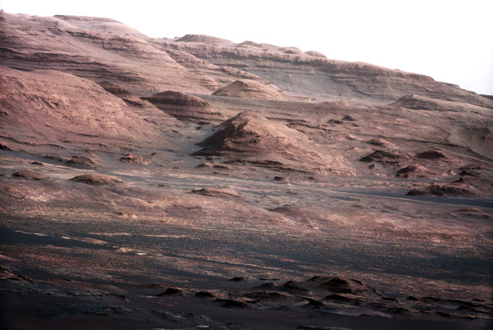
Caption
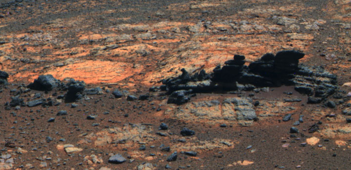
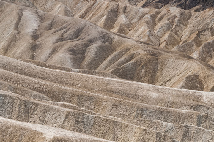
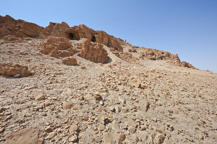
A chapter of the layered geological history of Mars is laid bare in this postcard from NASA’s Curiosity rover. The image shows the base of Mount Sharp, the rover’s eventual science destination.
This image is a portion of a larger image taken by Curiosity’s 100-millimeter Mast Camera on Aug. 23, 2012. Scientists enhanced the color in one version to show the Martian scene under the lighting conditions we have on Earth, which helps in analyzing the terrain.
For scale, an annotated version of the figure highlights a dark rock that is approximately the same size as Curiosity. The pointy mound in the center of the image, looming above the rover-sized rock, is about 1,000 feet (300 meters) across and 300 feet (100 meters) high.
Rights
Photos downloaded from the Essential Lens site are cleared for educational use only.