


Essential Lens: Analyzing Photographs Across the Curriculum
Processes of Science: Mars, a Case Study #6007 McLaughlin Crater Image Clues

Metadata
Date: January 20, 2013
Location: Mars
Photographer: NASA’s Mars Reconnaissance Orbiter
Source: NASA/JPL-Caltech/Univ. of Arizona
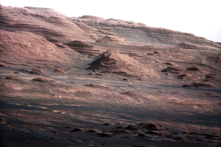
Caption
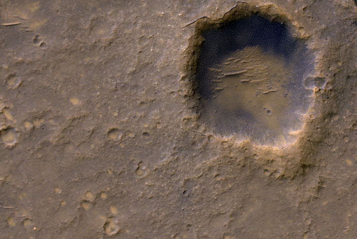
This view of layered rocks on the floor of McLaughlin Crater shows sedimentary rocks that contain spectroscopic evidence for minerals formed through interaction with water. The High Resolution Imaging Science Experiment (HiRISE) camera on NASA’s Mars Reconnaissance Orbiter recorded the image.
A combination of clues suggests this 1.4-mile-deep (2.2-kilometer-deep) crater once held a lake fed by groundwater. Part of the evidence is identification of clay and carbonate minerals within layers visible near the center of this image. The mineral identifications come from the Compact Reconnaissance Imaging Spectrometer for Mars (CRISM), also on the Mars Reconnaissance Orbiter.
The scene covers an area about one-third of a mile (about 550 meters) across. North is up.
Rights
Photos downloaded from the Essential Lens site are cleared for educational use only.