Plates & Boundaries
The earth's continents are constantly moving due to the motions of the tectonic plates. Closely examine the map below, which shows the 15 major tectonic plates.
As you can see, some of the plates contain continents and others are mostly under the ocean. The type of crust that underlies the continents is called continental crust, while the type found under the oceans is called oceanic crust. Continental crust is thicker — about 20 to 40 miles (35 to 70 km) thick — and usually older than oceanic crust, which is only 4 to 6 miles (7 to 10 km) thick. All the plates have names, usually referring to landmasses, oceans, or regions of the globe where they are located.

The border between two tectonic plates is called a boundary. All the tectonic plates are constantly moving — very slowly — around the planet, but in many different directions. Some are moving toward each other, some are moving apart, and some are sliding past each other. Because of these differences, tectonic plate boundaries are grouped into three main types.
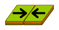
A convergent boundary occurs where two plates are pushing toward each other.
Examples of convergent boundaries include:
- the boundary between the Eurasian Plate and the Indian Plate at the Himalayas
- the boundary between the Nazca Plate and the South American Plate along the west coast of South America
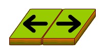
A divergent boundary marks two plates that are moving apart from each other.
Examples of divergent boundaries include:
- the boundary between the African Plate and the Arabian Plate in the Red Sea
- the boundary between the Pacific and Antarctic Plates
- the Mid-Atlantic Ridge, made up of the boundary between the North American and Eurasian Plates in the North Atlantic, crossing Iceland, and the South American and the African Plates in the South Atlantic
A transform boundary occurs where two plates slide past each other.
![]()
Examples of transform boundaries include:
- the boundary between the Pacific Plate and the Australian Plate, crossing New Zealand
- the boundary between the Pacific Plate and the North American Plate in California
Use the map below to see where the three different types of plate boundaries are found throughout the world.
First, find the KEY in the green box located at the bottom of the map. Then, select each boundary name in the KEY to see its location.
|
|
Plates & Boundaries Challenge See how many of the tectonic plates and boundaries you can identify. |
Image credit: Maps based on illustrations created at the University of Sydney and by the NASA/Goddard
Space Flight Center Scientific Visualization Studio. The map at the bottom of the page shows approximate locations of the tectonic plate boundaries.